
Ask most people about the top destinations in Argentina, starting with the capital of Argentina, Buenos Aires, and a familiar list of popular places usually follows. There is Iguazú Falls, a thundering wall of waterfalls shared with Brazil and best reached from the town of Puerto Iguazú on the Argentine side. There is Mendoza, where vineyards stretch out beneath the Andes, and Córdoba, with its old Jesuit architecture and lively student-city feel. Head south and you find San Carlos de Bariloche, a lakeside town with its own ski slopes at Cerro Catedral, or the beach resort of Mar del Plata, where tourists flock each summer. Further south still, Puerto Madryn serves as the gateway to the wildlife of Península Valdés. Most top 10 places lists mention all of these, and they earn their fame. But they are only one side of Argentina.
Head away from that familiar route and the country opens up into something far stranger and quieter. A high desert plateau where flamingos gather by the thousand. Salt flats that stretch to the horizon under a sky so clear it feels close enough to touch. Villages so remote that the nearest neighbour might be a volcano rather than another house. And, at the opposite end of the country, glaciers and granite peaks mark the edge of the inhabited world, far beyond the usual things to do in Argentina.
Argentina shares this side of Latin America with Chile, Bolivia and Peru, and some of the most remarkable places in Argentina sit close to those borders, among some of the continent's wildest natural landscapes. Treat this guide as a road trip through two very different natural wonders: the high north and the deep south. Some of these stops make an easy day trip from a bigger town; others are a destination in themselves. Travelling through these places rarely means joining a crowd. It means small groups, slow roads, and landscapes that keep changing shape the longer you look at them. This guide follows that path, from a brief stop in the capital through the northern highlands and down to the wild south.
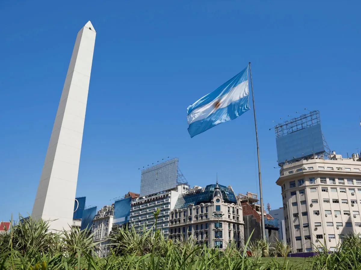
Buenos Aires: Worth a Visit Before You Go Further
Founded in 1580, Buenos Aires is the largest city in South America and still feels like it never quite sleeps. Hotels in Buenos Aires range from grand belle-époque buildings in the centre to sleek boutique hotels in Palermo, one of the city's trendiest neighbourhoods. Its nickname, the Paris of South America, comes from the grand European architecture that lines its avenues, but the city's real character shows itself in its neighbourhoods and in the sounds that fill its streets at the weekend.
Tango, San Telmo and La Boca's Caminito
San Telmo is one of the oldest parts of the city, known for its antiques market and cobbled streets full of stalls selling knick-knacks from another era. From there, most visitors head to La Boca, home to Caminito Street and its rows of brightly painted houses, as well as La Bombonera, the stadium of the Boca Juniors football club. Tango began in bars and dance halls like these, and it still lives on today in the milongas where locals gather to dance, as well as in the more polished shows staged for visitors. At weekends, the city takes on a different rhythm again out at Mataderos, a gaucho market where local groups perform songs from their home towns and horsemen demonstrate skills passed down through generations.
Recoleta's Grand Cemetery and Evita's Resting Place
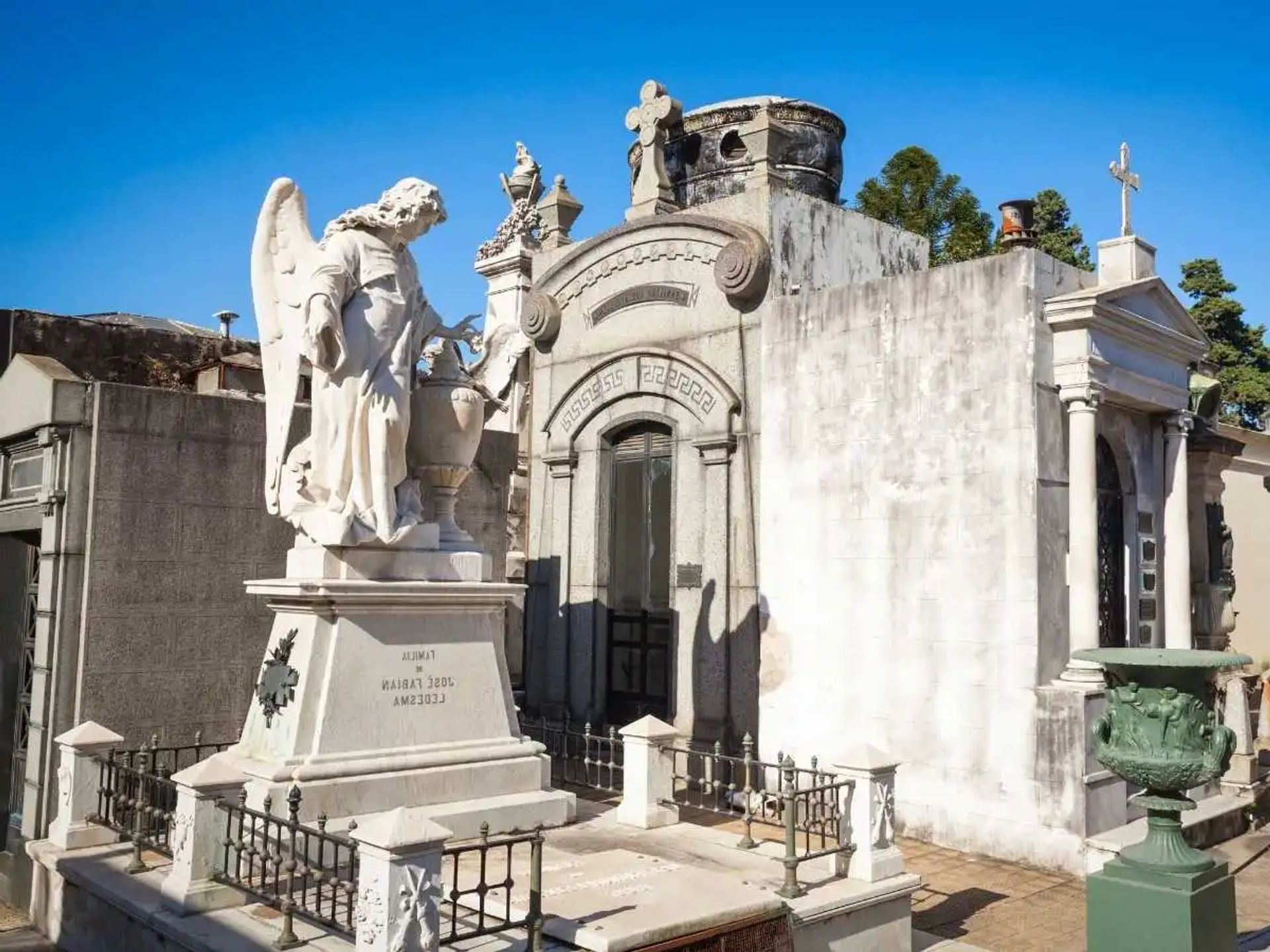
Recoleta is a different kind of neighbourhood altogether, with wide avenues, leafy parks and grand residences. Recoleta Cemetery is one of the city's most visited sites, a maze of ornate mausoleums where Eva Perón and other notable Argentines are buried. Buenos Aires has more than fifty museums in total, many holding private collections that trace the country's history from ornate silver mate pots to nineteenth century fashion. The nearby Colón Theatre, an opera house famous the world over for its acoustics, hosts choral and orchestral performances of a very high standard, and is worth a look even if you are not attending a show.
Salta and the Quebrada de Humahuaca: Argentina's Painted Valley
A short flight north takes you to Salta, a city with a distinctly Spanish colonial feel. Its streets are lined with whitewashed buildings, wrought iron balconies and old Andalusian style houses, and a recent restoration of the old centre has brought new restaurants and life to the area after dark.
Salta's Colonial Streets and Inca History
A walking tour of Salta usually takes in the Main Plaza and its historical buildings, including the Cathedral, the Church of San Francisco and the San Bernardo Convent. The city's Museum of High Altitude Archaeology holds one of Argentina's more remarkable discoveries. In 1999, archaeologists uncovered an Inca sanctuary near the Llullaillaco volcano, finding the remarkably well preserved remains of three children alongside more than a hundred gold and silver artefacts. The museum tells that story in full, and it is one of the few places in the world where you can see high altitude Inca archaeology so closely.
Purmamarca, Tilcara and Humahuaca's Craft Markets
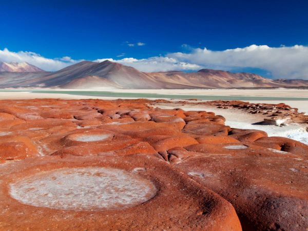
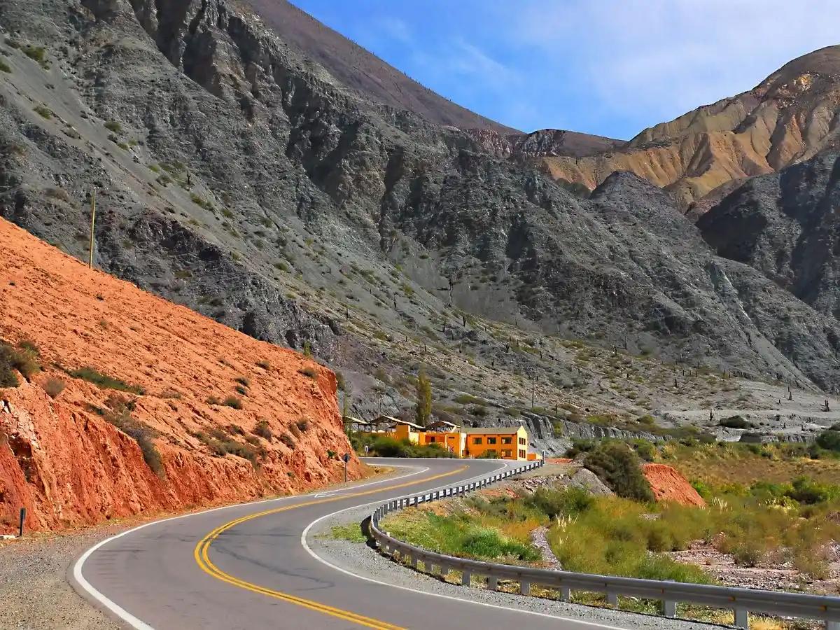
From Salta, the road climbs into the Quebrada de Humahuaca, a long valley running towards the Bolivian border in Jujuy Province. This is northern Argentina at its most colourful, and the valley's canyons and gorges have been carved by wind and water over millions of years, streaked with colour from mineral deposits laid down long ago. The journey includes a small hike into a hidden red gorge along with a stop at the Sacred Garden of Cardones, sitting at 3,200 metres. The villages of Tilcara, Purmamarca and Humahuaca are known for their craft markets and food stalls, including Humahuaca's lively market square. It is a slower, more textured side of Argentina than anything in the capital, and the drive alone, around 320 kilometres of paved road followed by a stretch of gravel track, climbing to over 4,300 metres at its highest point, gives a sense of just how vast this part of the country really is.
The Puna Plateau: Salt Flats, Flamingos and the Edge of the World
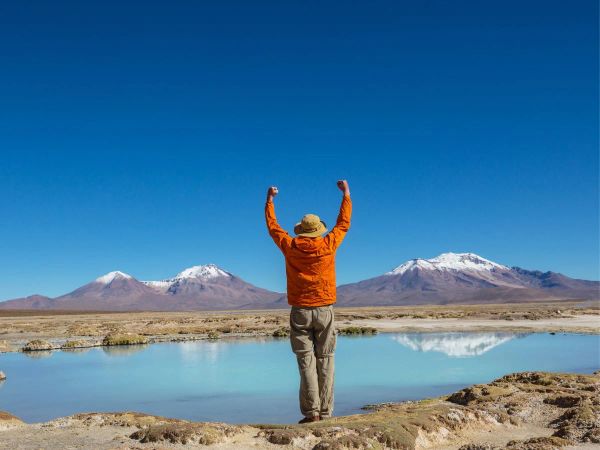
Beyond Humahuaca lies the Puna, a high plateau that few travellers ever reach. This is Argentina at its most remote, and it rewards the effort it takes to get there — one reason it features on our high-altitude salt flats trip.
Salinas Grandes and the High Road North
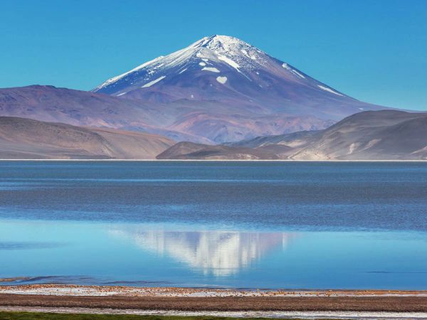
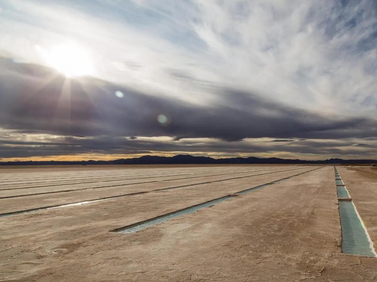
Salinas Grandes is a salt flat covering more than 30,000 acres, its surface so flat and white it can be disorientating to look at. The road there passes through the Cuesta de Lipan, a mountain route dotted with dry salt lakes, volcanoes and small groups of wild vicuñas. The old Puna capital of Susques sits along the route, home to a church dating back to 1598. From here, the road climbs to over 4,700 metres at the Paso de Jama before beginning its long descent towards the Chilean border, within a few hours of Santiago, with sweeping views over the Atacama Desert on the way down.
Tolar Grande and the Ojos del Mar Stromatolites
Tolar Grande is one of the most isolated villages in Argentina, reached only by a long drive across salt flats and desert tracks that can take the best part of a day. Nearby, the Ojos del Mar are a cluster of blue holes set in a white salt lake. In 2009, researchers discovered a colony of living stromatolites here, ancient life forms rarely found in such conditions anywhere in the world. A short hike to a hidden dune gives a full view over the surrounding desert, from the sacred Macón Mountain to the distant Llullaillaco volcano, standing at 6,735 metres. Close by, the abandoned railway station at Caipe once carried minerals from local mines towards Salta by cargo train, and from its platform there are striking views over the giant Salar de Arizaro, a name that translates roughly as Vultures Cemetery, a reminder of how harsh crossing this salt flat once was for the shepherds and animals that made the journey.
El Peñón, Campo de Piedra Pómez and the Flamingo Lagoons
Further south, the landscape turns volcanic. Along the way, the oasis of Antofalla supports a tiny community of around sixty people, its poplar, molle and willow trees fed by a natural spring in the middle of the desert. Antofagasta de la Sierra, meaning place where the sun shines, is a larger village of around eight hundred people surrounded by volcanic peaks, and was once the biggest stopping point on the old trade route linking this side of the Andes to the Atacama.
Campo de Piedra Pómez itself is a field of pumice rock shaped by an ancient volcanic eruption, carved over time by the region's fierce winds into strange, twisted forms unlike anything found elsewhere in Argentina. Nearby lagoons, including the Laguna Grande Reserve, draw enormous numbers of Puna flamingos, sometimes more than 19,000 birds, alongside the Andean flamingo and other high altitude wildlife. Overlooking it all is Cerro Galán, one of the largest volcanic calderas in the world, measuring 34 kilometres from north to south and formed by an eruption some 2.2 million years ago. Within its walls sits Laguna Diamante, a lake sheltered from the wind that provides a home for flamingos and ducks in an otherwise harsh, exposed landscape.
Cafayate and the Wine Route of the North
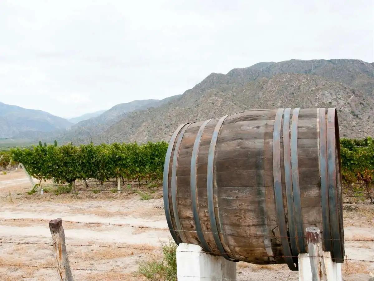
The Puna eventually gives way to gentler country around Cafayate, the centre of Argentina's northern wine region and home to the Torrontés grape, a white variety that thrives in this high altitude climate.
Quilmes Ruins: Argentina's Pre-Inca Stronghold
On the way, the Quilmes Ruins mark one of the most significant pre-Inca archaeological sites in the country, the remains of a settlement with a long and difficult history tied to the eventual fall of the Quilmes people. Close to Cafayate, the Quebrada de las Conchas cuts through sedimentary rock formations that are around a hundred million years old, their colours shifting with the light throughout the day. The route continues along Ruta 40, one of the longest and most celebrated roads in the world, passing small ranches, vineyards and the Quebrada de las Flechas, a desert of quartz ash shaped by 500 million years of geological history.
Molinos, Cachi and Los Cardones National Park
The drive from Molinos back towards Salta passes through four distinct ecosystems in a single day, from lush green valleys to semi desert. The road climbs over the Piedra del Molino Pass at 3,457 metres before dropping down into Salta's Valle de Lerma at just 1,200 metres. Inside Los Cardones National Park, giant cardón cacti, a protected species, stand in their thousands across a red desert landscape, while condors circle overhead and guanacos and wild donkeys graze nearby. It is one of the most scenic drives in the whole of northwest Argentina, and a fitting last stretch before returning to Salta.
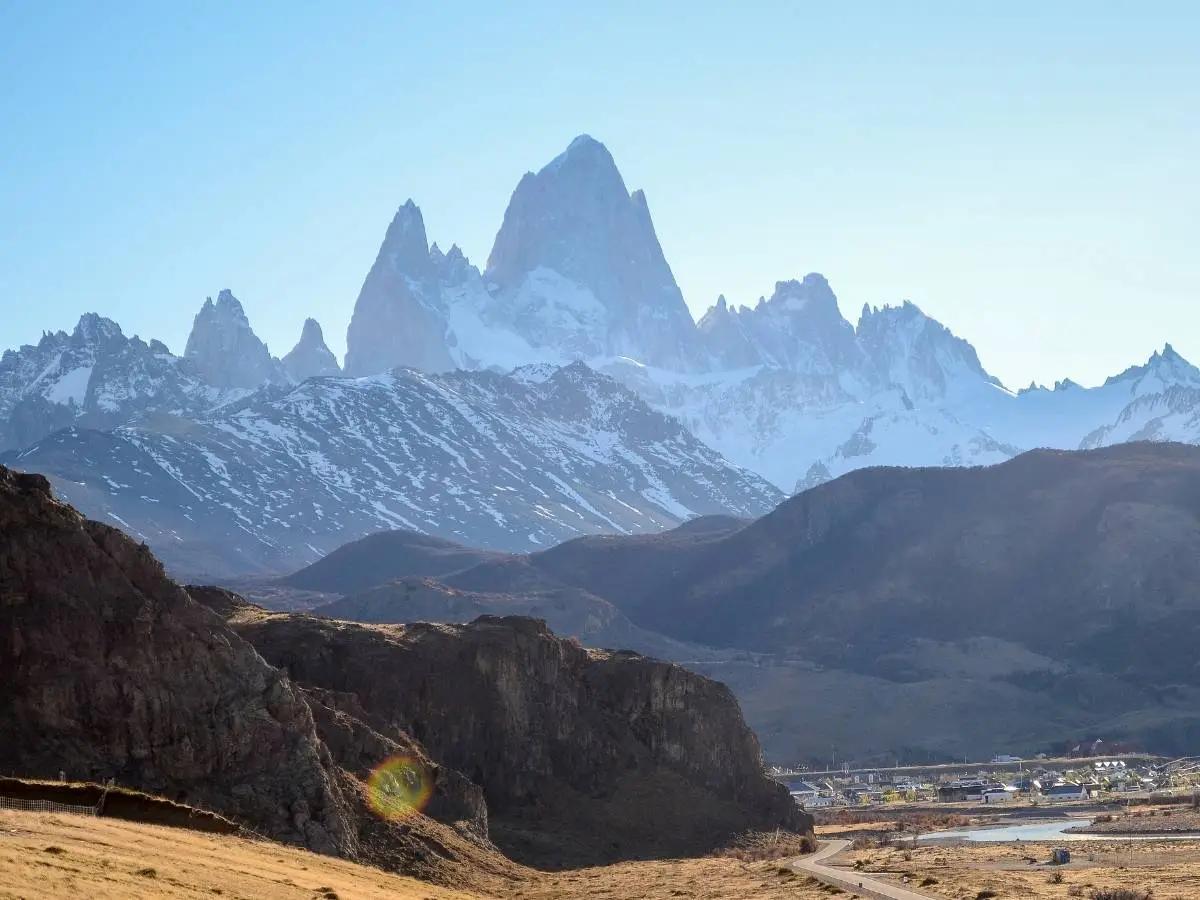
Patagonia: Glaciers, Granite Peaks and the End of the World
At the opposite end of the country, Patagonia offers a completely different kind of wild. This is a land of ice, mountains and long horizons, and it feels a world away from the deserts of the north — one best explored on a small-group Patagonia trekking trip.
El Chaltén and the Hiking Trails to Fitz Roy and Cerro Torre
El Chaltén is Argentina's trekking capital, sitting beneath two of Patagonia's most recognisable peaks. The walk to Laguna Torre takes seven to eight hours and passes through wide glacial valleys and dense forest before reaching a viewpoint over the Torre massif and its glaciers, along with old base camps once used by famous climbers. Further along, the trail to Laguna de los Tres, sometimes known simply as Laguna Los Tres, takes eight to nine hours and leads to Mount Fitz Roy itself, passing lakes of shifting blue, including a viewpoint over Laguna Sucia, and glaciers used as training grounds by climbers from around the world. Neither walk requires previous trekking experience, though a reasonable level of fitness helps. For a gentler day, Lago del Desierto offers a glacial lake surrounded by forest and snow capped mountains, best explored by a short boat trip followed by a walk along its shore.
El Calafate and the Perito Moreno Glacier, Gateway to Los Glaciares National Park
South of El Chaltén, near El Calafate, the Perito Moreno Glacier is one of Patagonia's true landmarks, sitting around 80 kilometres from town. Both this glacier and the Fitz Roy massif lie within Los Glaciares National Park, a UNESCO World Heritage site that protects one of the largest ice fields outside the polar regions. The drive there shows the landscape shifting from dry steppe to dense Andean forest over the final stretch. A network of walkways, around five kilometres in total, gives visitors a close and safe view of the ice from several angles.
Ushuaia and Tierra del Fuego National Park
At the very tip of the continent lies Ushuaia, the world's southernmost city. Tierra del Fuego National Park, established in 1960, protects a mix of sub-Antarctic forest and coastline along the Beagle Channel, with short walking trails and viewpoints such as Roca Lake offering good photo opportunities. At Lapataia Bay, a simple wooden sign marks the end of Route 3, known locally as the Panamericana Highway. Boat excursions from Ushuaia pass Birds Island, home to cormorants, skuas and seagulls, and Sea Lions Island, where colonies of southern sea lions and fur seals gather. The Les Eclaireurs Lighthouse, often mistaken for an end of the world marker, stands nearby as one of the region's most photographed sights. Ushuaia is also the main departure point for expedition voyages to Antarctica, though that is a very different kind of trip altogether.
What This Trip on Small Group Tours Is Really Like
Reaching places like these takes a different kind of trip to a standard city break, and it helps to know what to expect. The Puna plateau sits at serious altitude, with some routes climbing above 4,700 metres and overnight stays as high as 3,500 metres, so travellers need to take the thinner air seriously and allow time to adjust. You do not need to be an athlete to enjoy this region, but a reasonable level of fitness and some experience of regular walking makes the days more comfortable, since accommodation is simple rather than luxurious and porterage is not always available at smaller guesthouses, so it's worth reading our Argentina travel safety notes before you go.
Patagonia asks something different of visitors. Weather here can turn in minutes, and even a summer trek can bring four seasons in a single day — our Patagonia weather by month breakdown explains what to pack for each season — so warm layers and rainwear matter more than they might elsewhere. Walks to Fitz Roy and Laguna Torre cover long distances over uneven ground, though neither demands technical climbing skill. In both regions, accommodation stays comfortable throughout, with no camping involved, though WiFi can be patchy or unavailable in the more remote stretches. None of this makes the regions difficult to visit. It simply means the reward, landscapes that most travellers never see, comes with a slightly slower and more considered pace of travel.
Itinerary Ideas for a First Trip to These Undiscovered Destinations in Argentina
From the painted valleys of the north to the glaciers of the far south, Argentina's most memorable places are rarely the ones on a postcard. They are the salt flats crossed by llama caravans, the villages where the nearest neighbour is a volcano, and the trails that lead to the base of a mountain climbers have chased for generations. Conditions and daylight hours shift enormously between the two regions, so it's worth checking our Argentina seasonal planning guide before you fix on dates. Undiscovered Destinations builds its small group tours around exactly this kind of Argentina, the one that takes longer to reach and stays with you longer once you leave — see the full route on our small-group Argentina trip. If the usual list of places to visit in Argentina has started to feel familiar, perhaps it is time to look at the map a little differently.